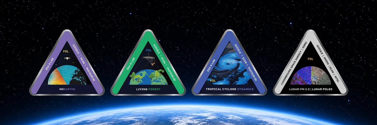
For the last seven years, Scan has supported Earth Systems Lab (ESL) research, and more recently, the Lunarlab projects too. In doing so, we are part of a great scientific initiative using AI to tackle some of the biggest challenges facing humanity today. Working in conjunction with Trillium, the organisers of ESL and Lunarlab, NVIDIA, the European Space Agency (ESA) and Google, each year’s labs take place over an eight-week intensive research sprint to accelerate scientific advancements and outcomes.
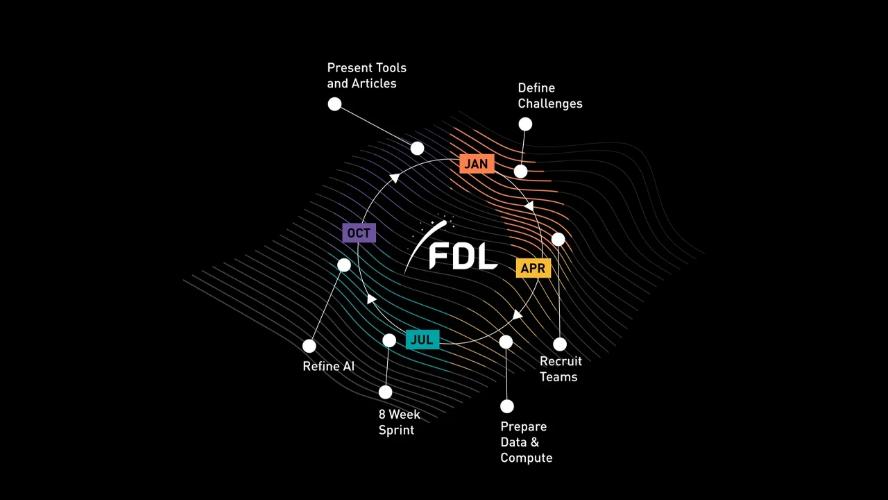
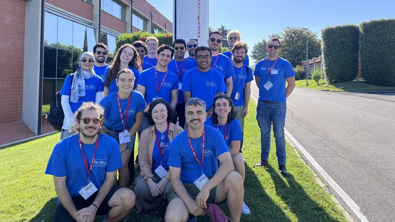
After months of preparation behind the scenes, the four scientific challenge sprints are now well underway and we can bring you a review of each one and progress up to the mid-way week four point.
MoEarths
The first ESL challenge, MoEarths (Mixture of Earths), proposes to build a mixture of experts (MOE) multimodal foundation model to better address the interlinked nature of Earth climate systems. The problem lies in the nature of the current range of fragmented models that deliver results in different formats and resolutions, making conclusion-drawing difficult.
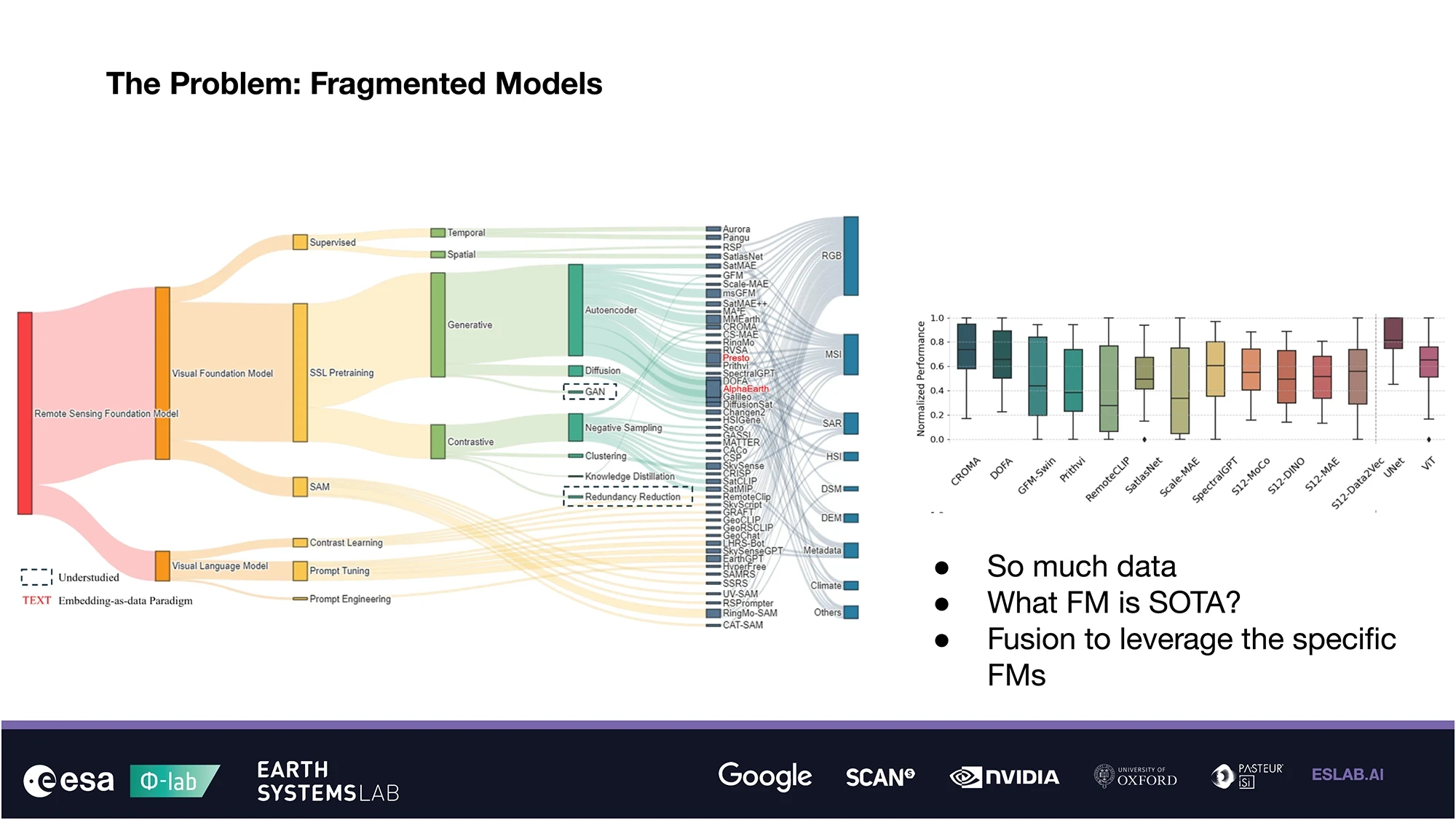
Building on previous work, MoEarths will use data from MAESTRO (Multi-domain Assessment for Embedding Scientific Results and Outcomes) including the Clay, Prithvi and ESL 2024’s SAR-FM geo-foundation models, in conjunction with the ESL 2025 SHRUG-FM model, to dynamically weigh the experts based on real-time geographic and semantic context, sensor modality and uncertainty.
The AI innovation opportunity this represents is significant, as when faced with a carbon-auditing scenario involving a tropical forest under heavy cloud cover, the MoEarths model could be expected to autonomously detect a high out-of-distribution signal from optical experts such as Clay, and shift weight towards SAR-based experts (synthetic aperture radar) capable of penetrating the canopy. This would offer a representation that is far more robust across varying regions and seasons than any standalone model, as MoEarths could be counted on to weight experts as required in line with the SHRUG parameters recognising when accuracy may be limited.
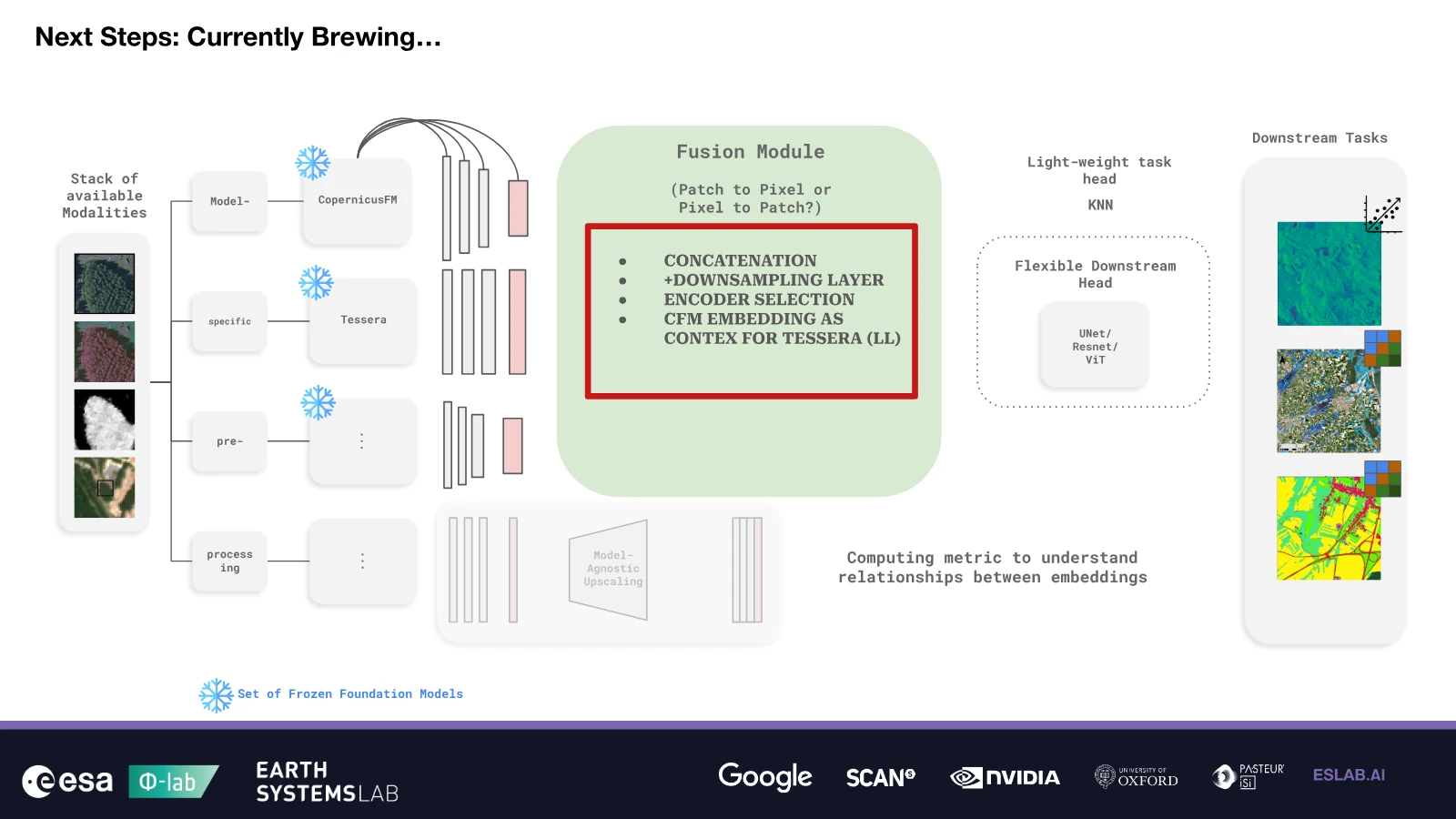
As of week four, the MoEarths team has defined its safe, stretch and bold goals, is progressing with its ML pipelines using land-based (FLAIR #2), flood mapping (Kurosiwo) and ground biomass (BioMassters) datasets for the initial model development, using a combination of CopernicusFM (unified data from all major European Copernicus Sentinel satellites), Tessera (for pixel-wide Earth observation) and DinoV2 (for extracting deep image embeddings) foundation models. It has formed two teams – the Benchmark team to assess the testing and performance of the datasets; and the Fusion team to work on the AI techniques for fusing the numerous data sources together.
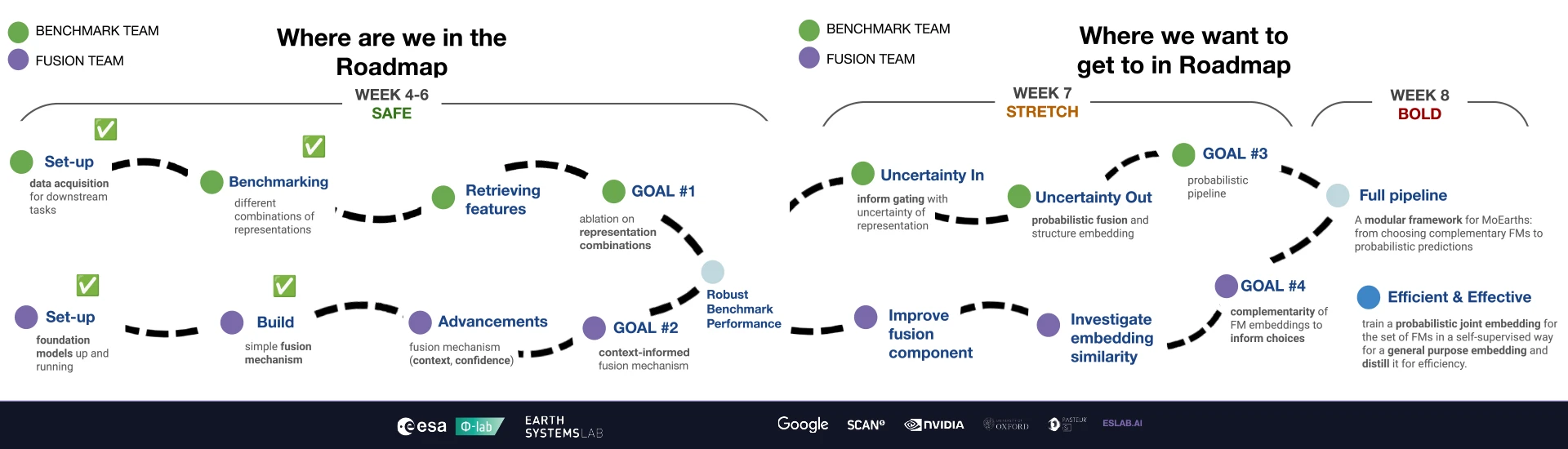
At this halfway stage the initial findings look promising, however the main concerns are whether to focus on pixel- or patch-level embeddings – better for segmentation and depth estimation or large-area comprehension and anomaly detection respectively. The team is also investigating several approaches as to how to bring all the experts to the same resolution in the fairest and most agnostic way to make the resulting FM the most generalisable.
Living Forest
The second ESL challenge, Living Forest, seeks to build another multimodal foundational model, this time focused on the Earth’s forests and biomass. The ESL 2024 3D SAR for Forest Biomass challenge showed it was possible to classify a forest from space to query its carbon sequestration capabilities with around 80% accuracy, with a view to applying it to biomass P-band data.
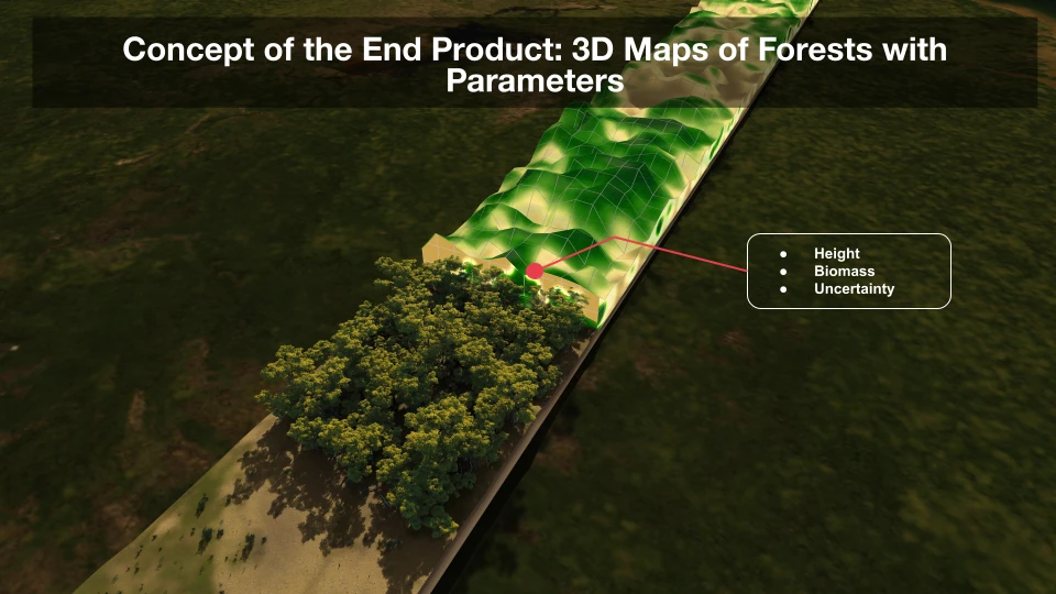
The 2026 challenge aims to better understand how to measure living forests to help track and manage their health and resilience over time, developing the first Dynamic Forest Foundation Model to learn the underlying physics of forests.
At the halfway stage, the Living Forest team has defined its goals, including a JEPA (Joint Embedding Predictive Architecture) approach, used for the first time at ESL. JEPA encodes two views of the same input into abstract embeddings – one as the context, and one as the target. The AI is forced to predict the representation of the target using only the context. The team deems this an important component of the model as JEPA mimics how humans learn from simple observation.
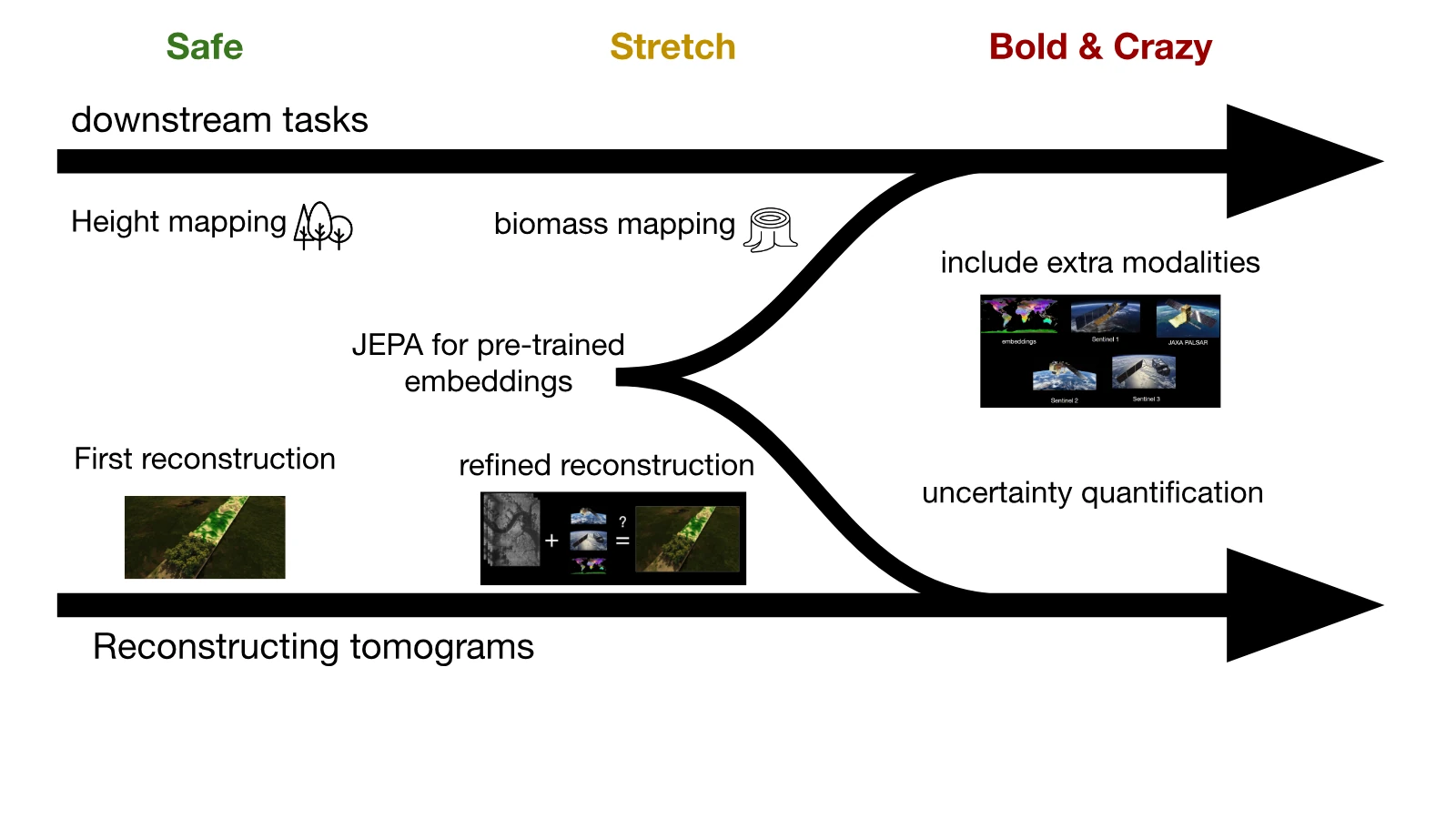
The team has completed the initial data preparation stages of its investigations and is progressing with the tomographic reconstruction process, using the information from the recently launched ESA Biomass Mission – firstly a 7-pass tomographic phase, followed by a 3-pass interferometric phase. These will be used to create detailed cross-sectional slices of forest biomass to generate a large dataset that will contribute to the training of the final FM.
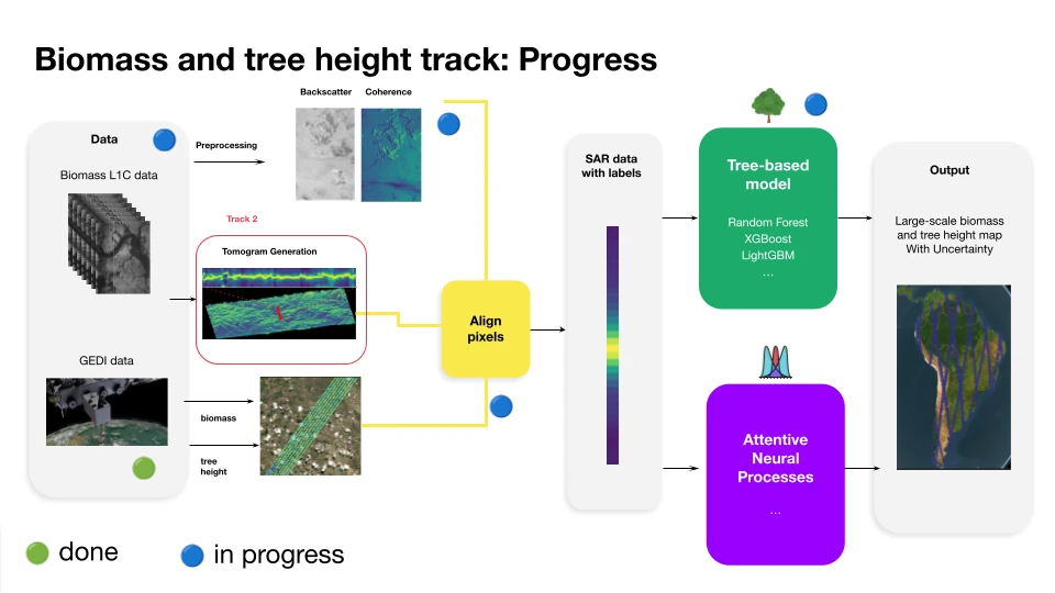
Although initial results involve small datasets and lack resolution, the outlook is positive, as training cycles scale, though a key challenge remains in how to best show the forest parameter model benefits from the 3D information, rather than a single pass.
Tropical Cyclone Dynamics
The third ESL challenge, Tropical Cyclone Dynamics, looks to address the gaps in our knowledge when it comes to predicting the intensity of tropical storms. Tropical cyclones, typhoons and hurricanes represent critical threats, causing billions in damages and long-lasting impacts on human lives. Despite advances in numerical weather prediction, a persistent resolution gap remains between global simulations and the fine-grained spatial structure of storms.
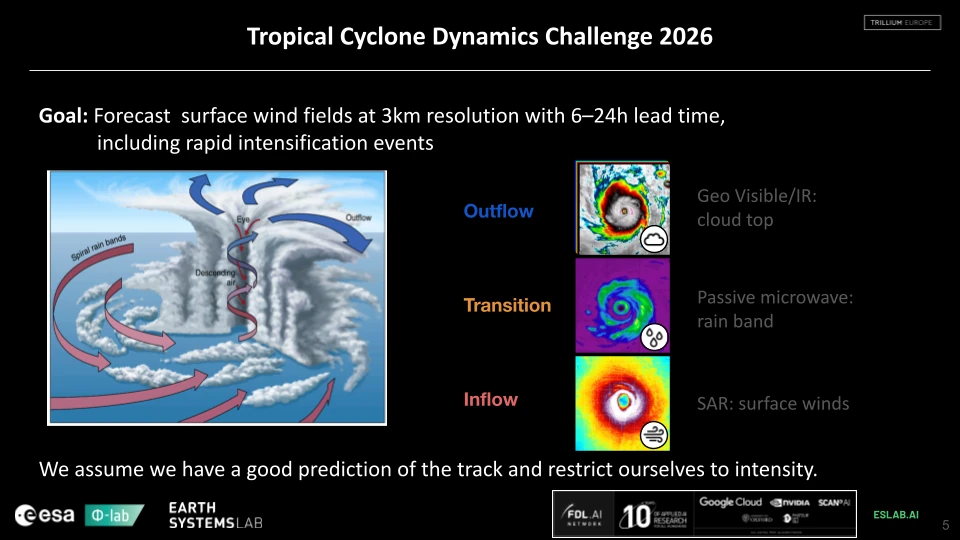
The 2026 approach is to build a novel multimodal AI model that fuses 3D cloud morphology with temperature, precipitation and SAR-measured wind speed for the first time. Building on the ESL 2024 3D Clouds Using Multi-sensors research, it is hoped to take the reconstruction of 3D cloud structures at a kilometre scale, and integrate the thermodynamic traits necessary to anticipate the destructive potential of rapid intensification events.
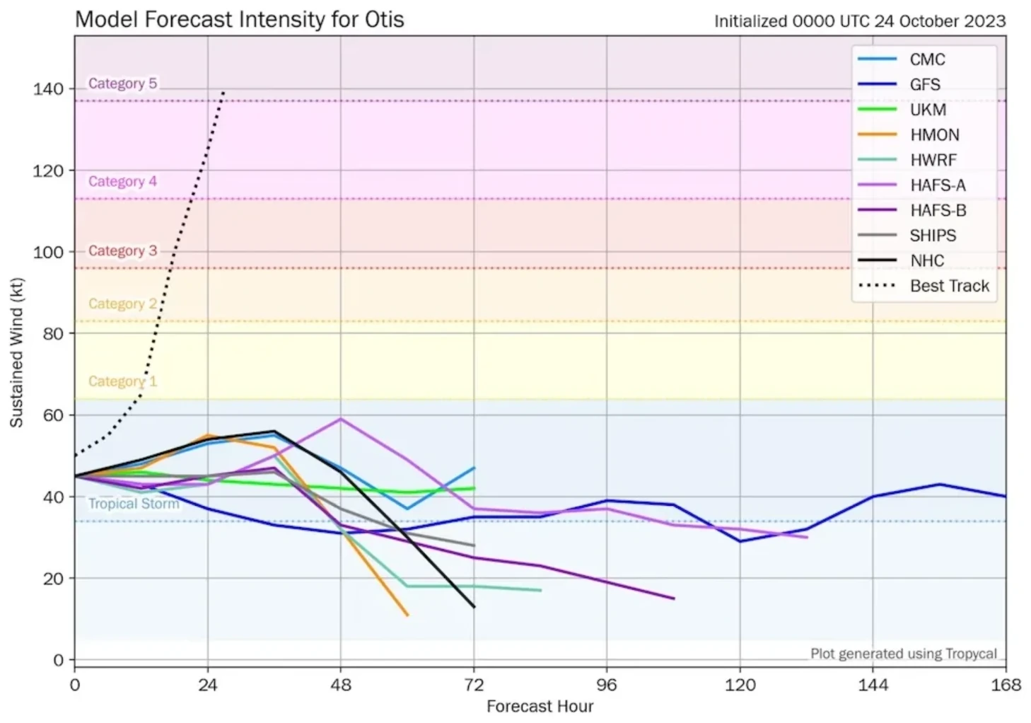
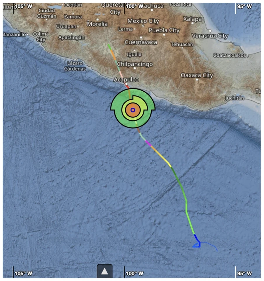
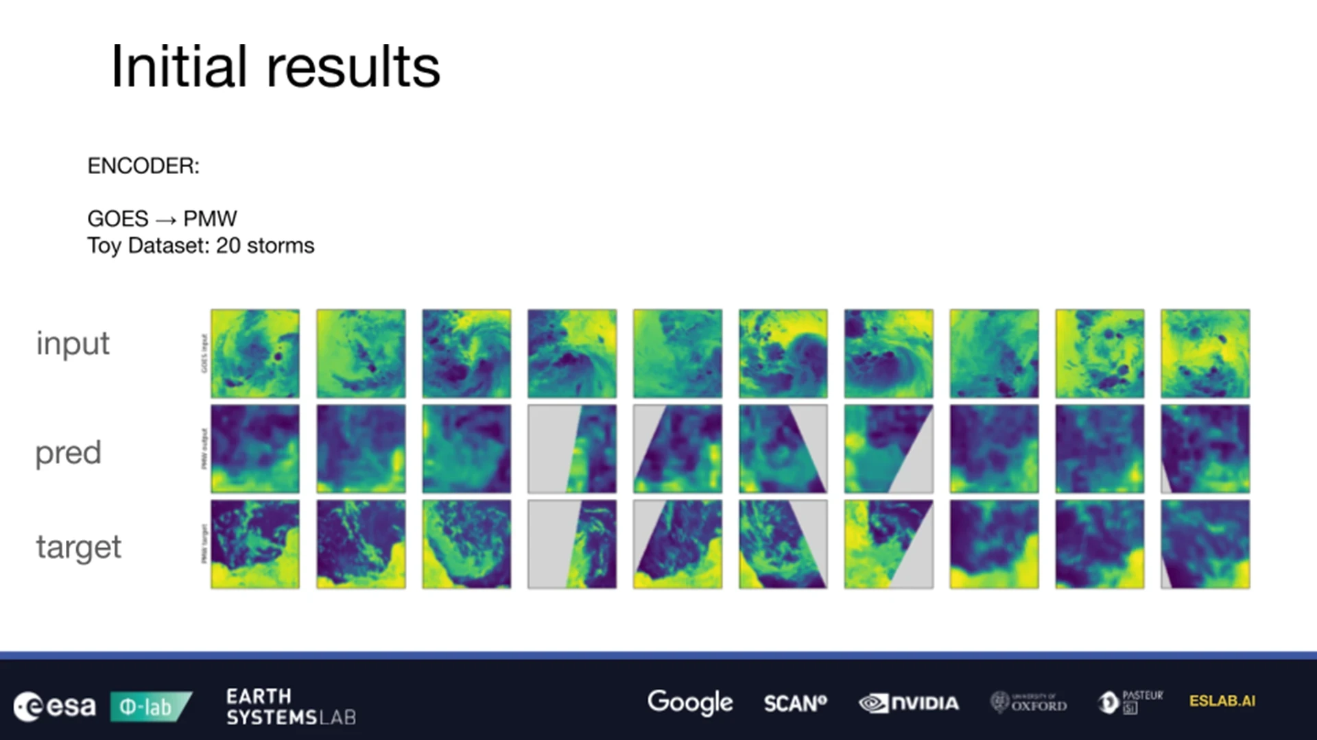
As of week four, the Tropical Cyclone Dynamics team has selected its datasets from satellites including NOAA (National Oceanic and Atmospheric Administration) GOES (Geostationary Operational Environmental Satellite) East and West, and Japan’s HIMAWARI-9. Also used were the TC PRIMED (Tropical Cyclone Precipitation, Infrared, Microwave, and Environmental Dataset) and CyClObs database, alongside the IBTrACS (International Best Track Archive for Climate Stewardship) database – specifically from 2023’s Hurricane Otis. Otis was of particular interest to the team as it caused huge devastation in Mexico due to existing prediction models failing to estimate how quickly it would intensify and make landfall.
Initial results (below) from a limited dataset model in the development phase lack resolution (pred – prediction) but are promising in that they are starting to resemble the desired results (target).
Lunar-FM 2.0 – Lunar Poles
The 2026 Lunarlab challenge is focused on developing a cognitive layer for the lunar frontier, building on the Lunarlab 2025 Lunar-FM multimodal lunar foundation model. This year’s research is focused on the lunar south pole, incorporating images from high-resolution, narrow-angle cameras (NACs), lower-resolution wide-angle cameras (WACs); and datasets including radiant energy temperature, gravity, radar and albedo (surface reflectivity) to provide a foundation model with pixel-level embeddings of around 1m resolution. These will be coupled with physics-based data from constraints in Digital Elevation Model (DEM) caused by shadows, to generate tokenisers for use with LLMs, enabling pixel-level embeddings at around 1m resolution and presenting a step forward in possible downstream multimodal operational applications.
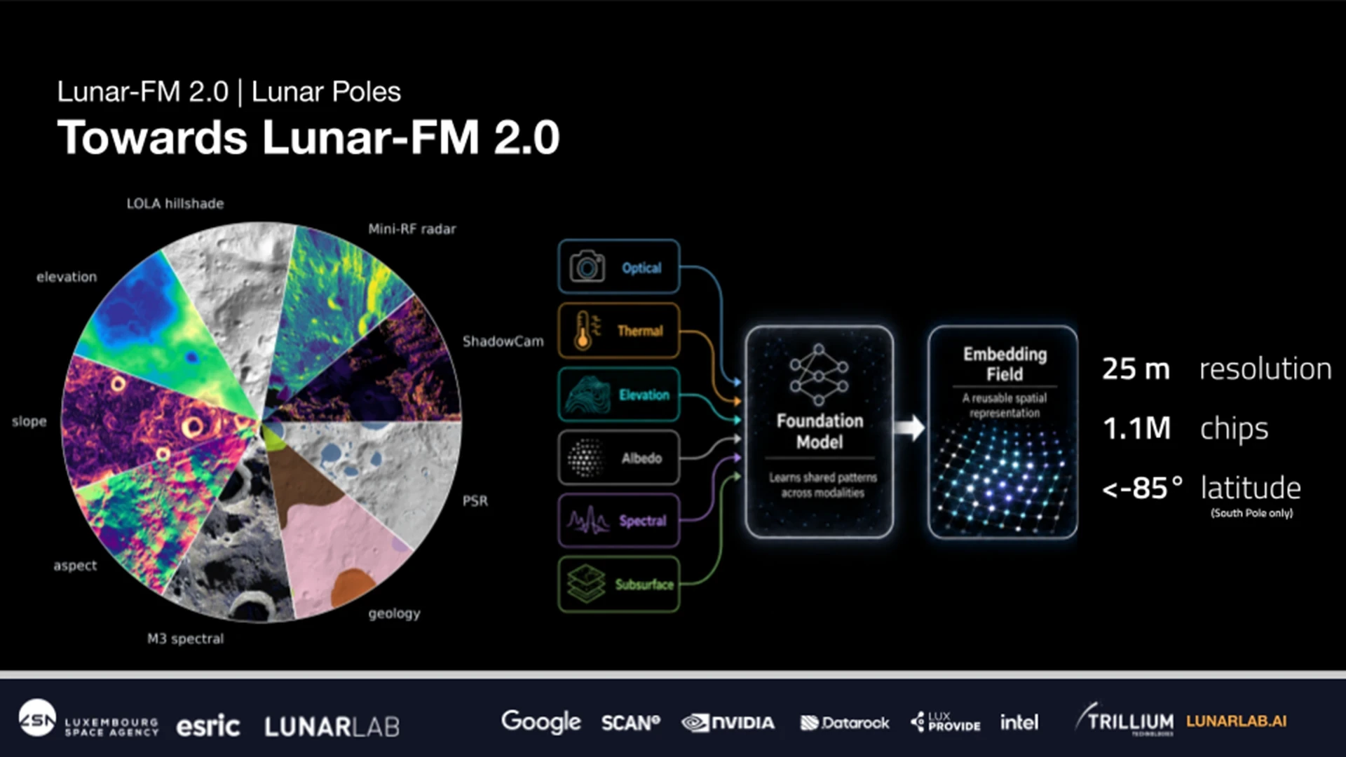
As of week four, the LunarFM 2.0 team has carried out numerous evaluations of datasets across several parameters – firstly a similarity search, where it will look to retrieve the regions most similar to query location and produce similarity maps that show look-alike terrain across the pole. Secondly, a principal component analysis (PCA) that distils high-dimensional embeddings into its key modes of variation, and quantifies how much structure each component captures. Finally, a clustering test will analyse groups into distinct terrain or feature types without labels, and report cluster metrics and assignments.
The results generate detailed representations of the south polar region showing rock formations – pre- or post-Nectarian (before or after the Nectaris impact events 3.9bn years ago), their illumination (sunlit or shadow) and whether it is a flat, rugged, crater, crater rim or mixed.
The final LunarFM 2.0 is expected to output via an interactive interface similar to the agentic nature of the original LunarFM.
It should enable queries designed to aid the upcoming Artemis Moon missions such as ‘Find regions similar to this high-science and high-accessibility site’, ‘Find regions dissimilar to this rejected landing zone’ or ‘Find sites similar to known high-science value targets, within 2km of a PSR, with >50% Earth visibility, and has short darkness intervals and low terrain uncertainty’.
What’s Next?
We’ll continue to report on the findings and hopeful successes of these important scientific research projects over the coming months, starting with a review of the 2026 Live Showcase event scheduled for August. In the meantime, you can see what AI has helped to discover over the past six years of projects in our previously published space and Earth science case studies.