
EnvirometriX Case Study: AI Workstations for Global Environmental Data Analysis
EnvirometriX and OpenGeoHub
OpenLandMap: Using machine learning for global good
PUBLISHED 15 JAN 2021
EnvirometriX improves the management of natural resources by promoting decision-making based on accurate, reliable and accessible information. It retrieves this information using state-of-the-art statistical and machine learning methods, coupled with sustainable technology.
OpenGeoHub is an independent not-for-profit research foundation promoting open source and open data solutions. Harnessing the power of machine learning and geo-computations, it enables and accelerates organisations in producing analysis-ready and decision-ready data.
Project Approach
EnvirometriX and OpenGeoHub both observed that there was a vast amount of legacy data on land use already publicly available, including observations of land cover, land use, soil properties and qualities. However, this data is systematically under-used despite its value. They decided to integrate, harmonise and process this underused data using state-of-the-art machine learning algorithms to extract valuable information patterns and trends not immediately recognisable from ground observations and remote sensing data itself. Furthermore, their aim was to automate this process and open it to all interested users, so that its use can be accelerated and empower others to create their own new open data.
EnvirometriX and OpenGeoHub worked with many partners including GILAB, Land Potential and Spatial Ecology to start a global predictive vegetation and soil mapping system. This would serve as an international reference for global planning and assessment projects, and facilitate easy access to environmental layers potentially important for spatial modelling, decision making and for raising public awareness about land degradation, land restoration and land potential.
Project Results
The end result of the collaboration was OpenLandMap — a data portal to the world's land use data, representing multiple environmental thematic fields such as buildings and settlements, elevation and depth, geology and soils, land cover and land use, population distribution, water, physical infrastructure, climate, biodiversity and nature conservation.
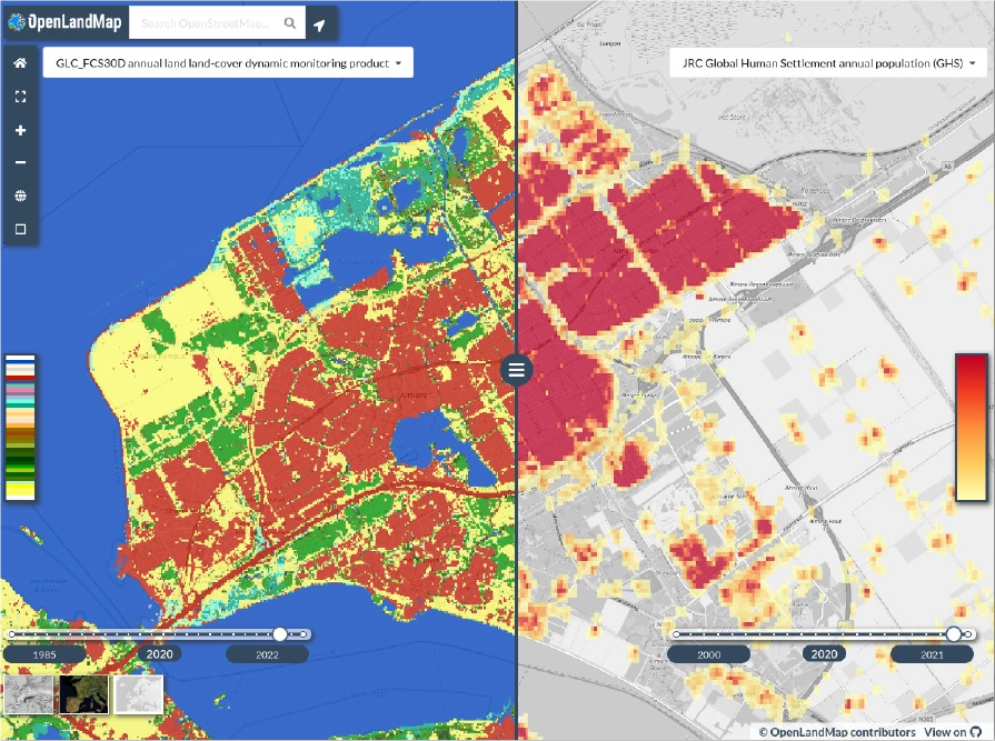
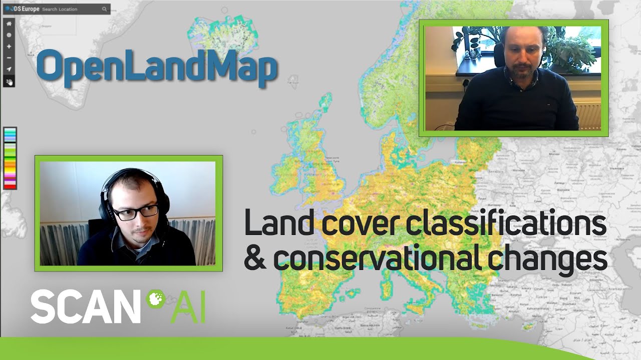
The OpenLandMap platform provides access to spatial layers covering global land mass at spatial resolutions of 1-km, 250-m, 100-m, 30-m or finer, and is hosted by the OpenGeoHub foundation. Access to the spatial layers is possible via interactive visualisations and the aim is to continuously add new layers, to help different groups fill in gaps in existing data and improve FAIRness (Findable, Accessible, Interoperable, and Reusable) of the data. Learn more about OpenLandMap's capabilities and uses by watching the video below.
The team's ultimate goal is to produce an analysis-ready (complete, consistent, current and correct) cloud-optimised data cube that is available unrestricted and through a federated approach.
The Scan Partnership
Scan provided bespoke AI workstations and servers designed and built by their in-house 3XS Systems division. These cost-effective hardware platforms allowed EnvirometriX and OpenGeoHub to continue investing in their computing infrastructure whilst testing various GPU and CPU processing options, so that they can optimally utilise them in combination with cloud-based solutions.
Project wins
Analysis of multiple large datasets in minimal time to develop OpenLandMap
Supporting the organisations' open source ethos by facilitating a flexible machine learning approach
Supporting international initiatives by serving up the highest quality environmental data

Tomislav Hengl
Co-Founder, EnvirometriX & Senior Researcher, OpenGeoHub Foundation
"We found the new-generation Scan AI / ML-ready workstations especially suitable for start-ups and SMEs that cannot afford large dedicated spaces to run computing. We also find it great that their servers are quality-tested and optimised for Ubuntu OS."
Leandro L. Parente
Post-doctoral Researcher, EnvirometriX & OpenGeoHub Foundation
"Thanks to our Scan 3XS servers with large amounts over 400GB RAM, fast and silent CPU cores with 4TB SSD storage systems, we have managed to process terabytes of Earth observation data for the whole of Africa in weeks."
Speak to an Expert
You've seen how Scan helped EnvirometriX and OpenGeoHub use machine learning for global good. Contact our expert AI team to discuss your project requirements.
Related content
View more case studies
EnvirometriX
Learn more about data-driven decisions based on cutting-edge machine learning and optimised designs.
Read More
OpenGeoHub Foundation
Learn more about harnessing the power of machine learning and geo-computations for global good.
Read More
OpenLandMap
View OpenLandMap layers and interactive visualisations to further your research or advance your organisation's work.
Read More